Posted by
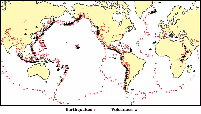
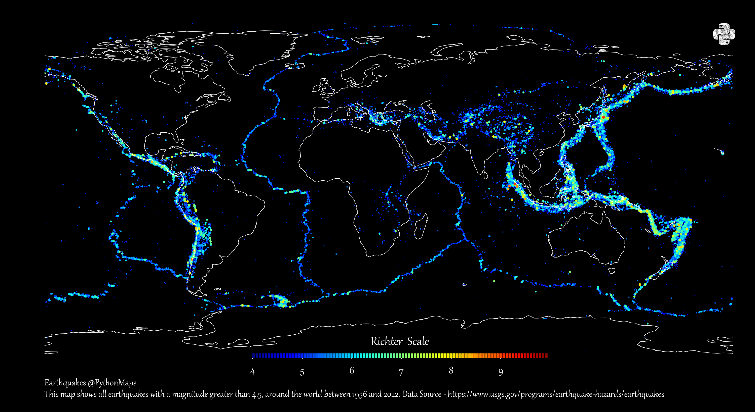
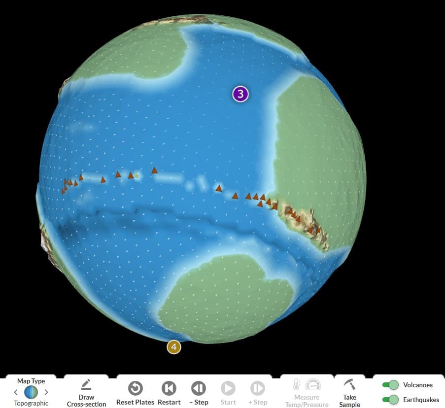
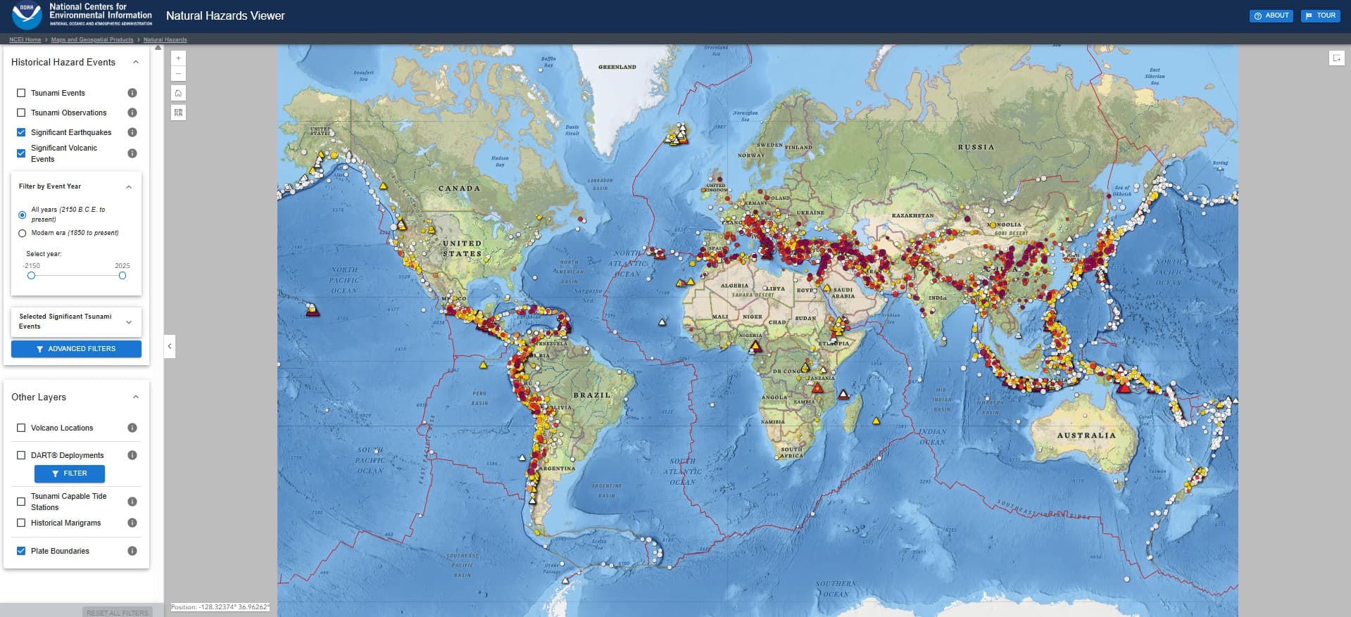
View maps of seafloor topography, earthquakes, and volcanic activity, which scientists use to create outlines of Earth's tectonic plates.
Findings
Additional insights we found via National Park Service
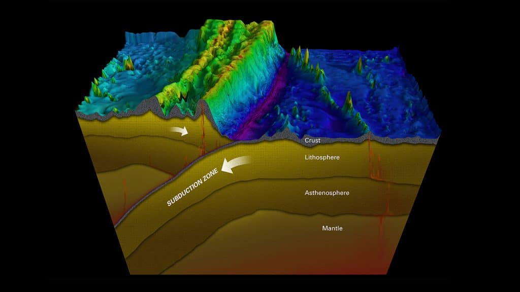
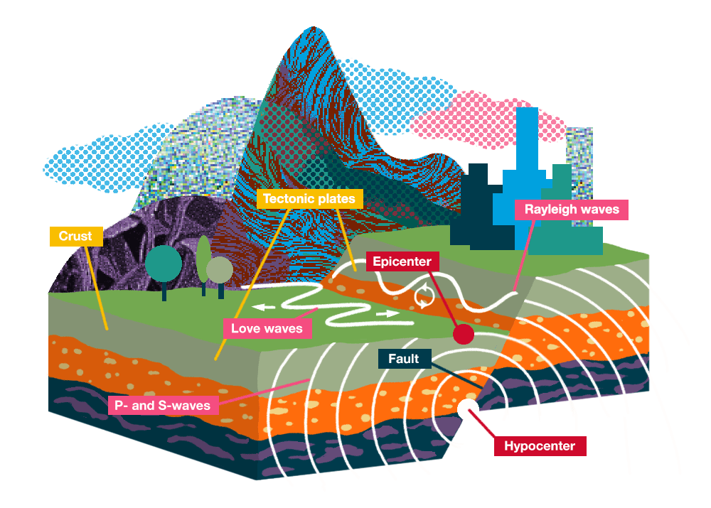
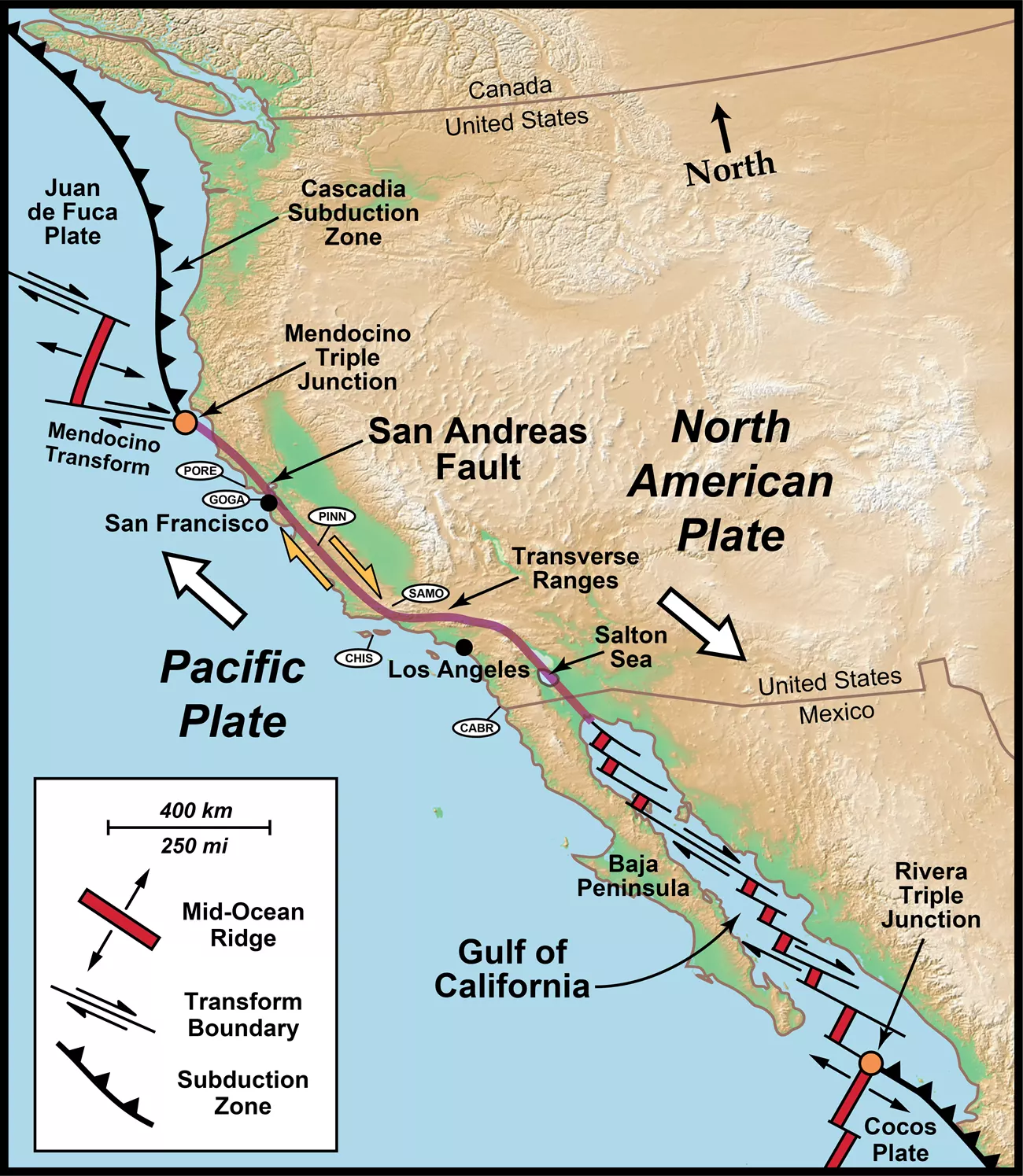
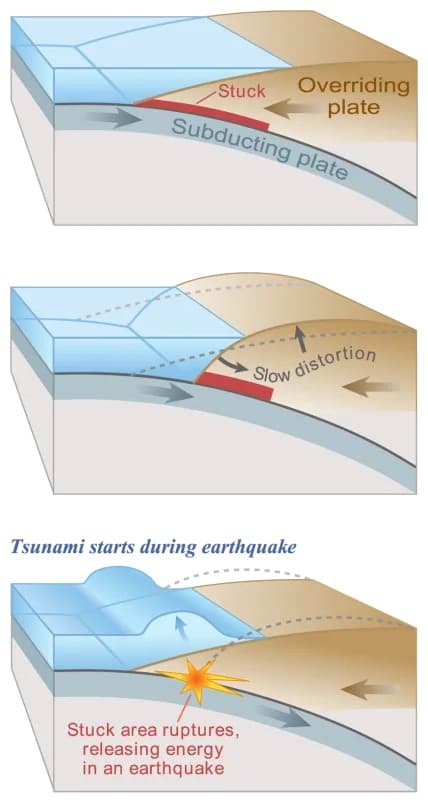
Earthquakes and volcanoes are most common at plate boundaries, where moving plates interact.
Besides mapping these events over time, plate movements can also be tracked via GPS satellites.
Similar Posts
Showing 1440 posts similar to “View maps of seafloor topography, earthquakes, and volcanic activity, which scientists use to create outlines of Earth's tectonic plates.”


You've reached the end.